
VLF, TDEM and TEM Electromagnetic Surveys
Two families of electromagnetic methods: VLF for rapid mapping of near-surface conductive anomalies, and TDEM – using point measurements or continuous profiling with the TEM2Go backpack system – to reconstruct subsurface resistivity without galvanic contact with the ground.
VLF method
The VLF method is based on electromagnetic induction and is suitable for locating electrically conductive, elongated, subvertical bodies. The primary field is generated by very-low-frequency transmitter stations located around the world. As the signal travels over long distances, it has a predominantly horizontal component and induces currents in buried conductors, which in turn generate a secondary field. Above the conductive body, the resulting field shows a positive peak before the body, a zero value directly above it and a negative peak immediately beyond it.
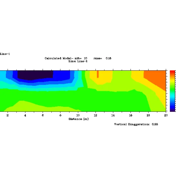
The resistivity values obtained vary with the material, the presence of soil or rock, cavities, the thickness of the detrital cover and moisture content.
VLF services
- Plan-view traverses measuring apparent resistivity contrasts
- High-frequency point mapping of anomalies up to 12 m from the sensor
- Areal mapping of aquifers using a low-frequency secondary field
TDEM method
The time-domain electromagnetic method (TDEM), developed for mineral exploration and later adopted in hydrogeology and environmental work, transmits a square-wave signal through a loop that is not connected to the ground. When the current is switched off rapidly, the changing magnetic field induces currents in the subsurface. These decay slowly in good conductors and rapidly in poor conductors; measuring the decay makes it possible to derive resistivity profiles as a function of depth.
TDEM services
- 1D soundings to identify electro-strata with defined resistivity
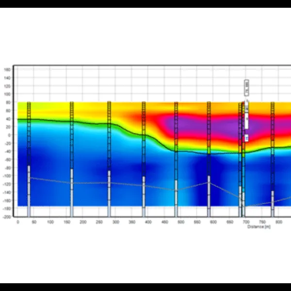
- 2D resistivity profiles combining multiple 1D soundings to investigate complex geological structures
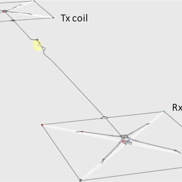
We use two 20 A systems: TEMcompany sTEM and ABEM WalkTEM2, with loops from 20×20 to 100×100 m, including fixed-loop and profiler configurations. Typical investigation depth is 200–600 m, depending on loop size and ground resistivity.
TEM2Go: continuous backpack TDEM (new for 2026)
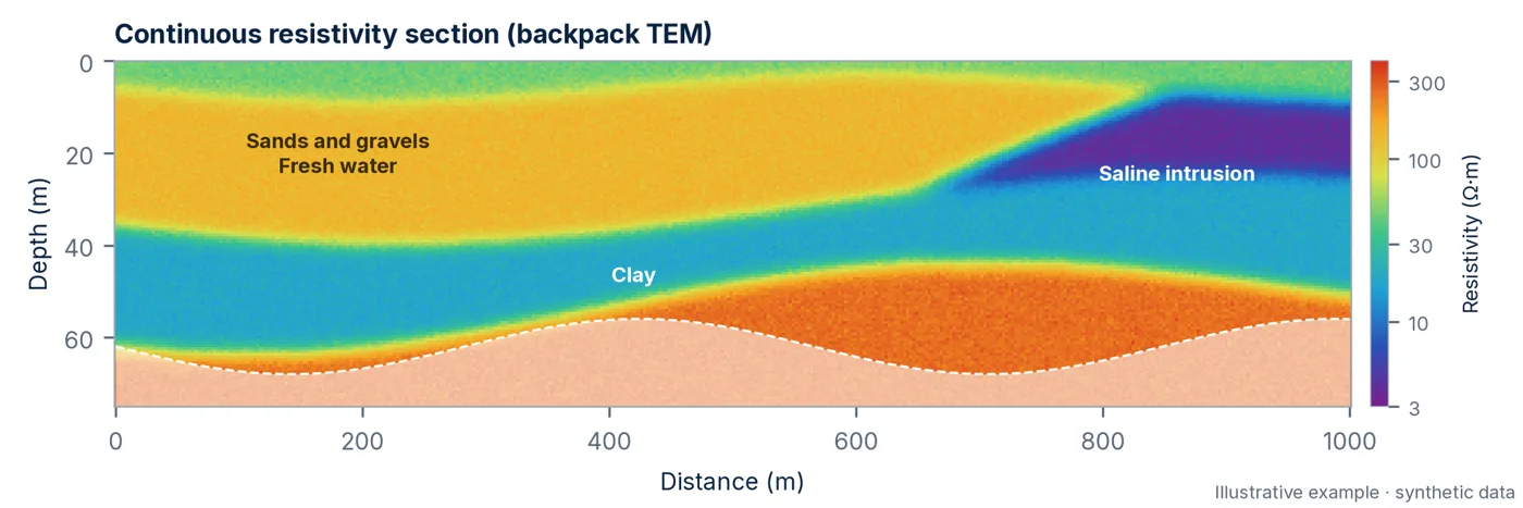
From 2026, our TDEM offering also includes TEM2Go: a backpack TDEM system operated by two people, with a wireless transmitter and receiver 15–20 m apart, GPS on both units and real-time data inversion in an app. It continuously measures approximately 1 km of profile in 10–15 minutes, with an investigation depth from the surface to around 75 m, depending on resistivity.
It is suited to shallow aquifers and managed aquifer recharge (MAR), construction sites, landfills and tailings storage facilities, and for identifying saltwater intrusion and clay layers along extended profiles. The total weight is approximately 25 kg.
- Continuous resistivity profiles over long distances
- Shallow aquifers and saltwater intrusion
- Landfills and tailings storage facilities
- Rapid screening before ERT or deeper TDEM surveys
Applications
- Aquifer exploration and mapping
- Faults, karst zones and fractured ground
- Buried structures and bedrock
- Cavities and archaeology
- Buried conductors: pipes, cables, drums, reinforcement and drains
- Mineral deposit mapping
- Soil contamination
- Geothermal resources
From TDEM soundings to a resistivity model
The diagram shows how multiple adjacent TDEM soundings, or a continuous profile acquired using the TEM2Go backpack system, combine to create resistivity sections: conductive and resistive subsurface layers emerge as continuous bodies along the profile.
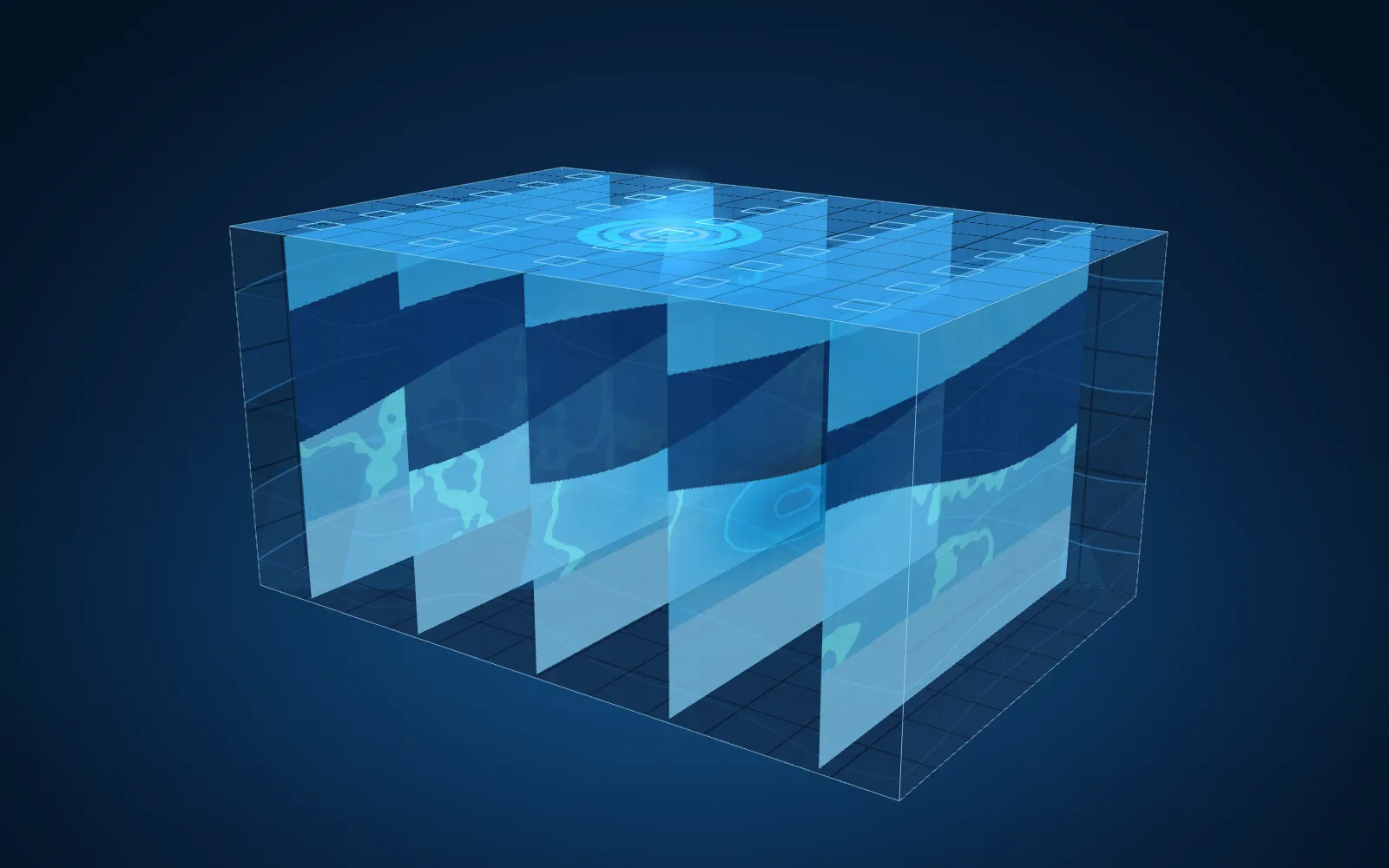
- Low resistivity, conductive
- High resistivity
- TDEM loops and soundings
Images and results
Often combined with this survey
Ready to get your project underway?
Send us the location and objectives of the survey: we will propose a suitable combination of methods and provide a detailed quotation.