
Geophysical surveys: seismic refraction, MASW and HVSR
We use seismic wave velocities to determine the geometry and elastic properties of soils and rock: seismic stratigraphy, Vseq in accordance with NTC 2018, the thickness of superficial deposits, bedrock and the site's resonant frequency.
Seismic surveys
Seismic surveys investigate the propagation of seismic waves, whether natural or artificially generated. These waves travel at different velocities through different lithologies and undergo reflection, refraction and diffraction at geological discontinuities. Velocity also varies within a single lithology according to its degree of compaction, fracturing and porosity.
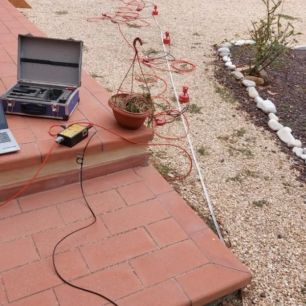
Waves are generated at a point on the ground using a sledgehammer or seismic gun, and recorded by geophones arranged along a survey line. Analysis of the seismograms reveals the geometry and elastic properties of the ground: P and S waves for refraction, reflection and Down-Hole surveys; Rayleigh and Love surface waves for MASW; and ambient noise for passive techniques.
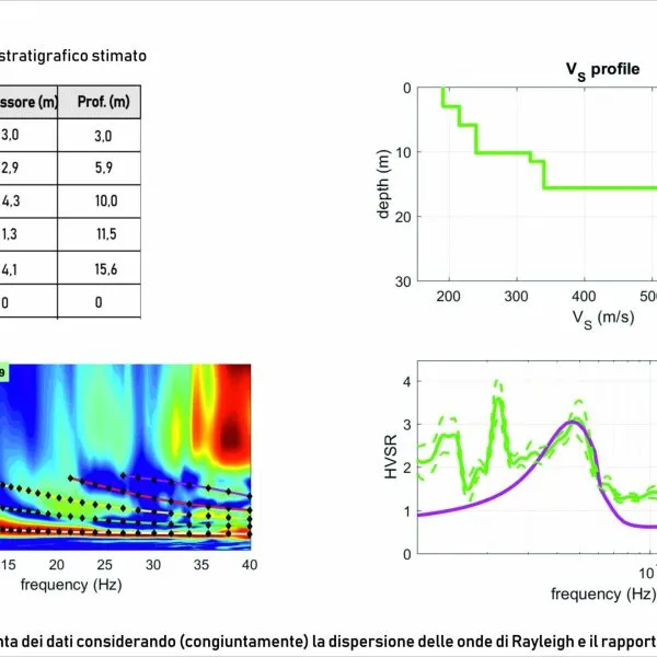
We also carry out joint processing: in addition to identifying modal curves, we integrate HVSR and ESAC curves to interpret the velocity spectrum at lower frequencies (<5–10 Hz), which represent the deeper parts of the model.
Dedicated method pages
Two methods have dedicated pages with animations illustrating how they work: seismic reflection, for bedrock, faults and deep aquifers, and Down-Hole and Cross-Hole seismic surveys, for Vp and Vs profiles and Vs,eq in accordance with NTC 2018.
3D ground-penetrating radar (GPR)
For the shallow subsurface – buried utilities, tanks, cavities and archaeological investigations – we use our own MALÅ 30-channel multi-antenna GPR system, described on its dedicated page: 3D multi-antenna GPR.
Services
- P- and Sh-wave seismic refraction
- Seismic reflection
- Down-Hole and Cross-Hole seismic surveys
- MASW using Rayleigh and Love waves
- Passive seismic surveys using ESAC
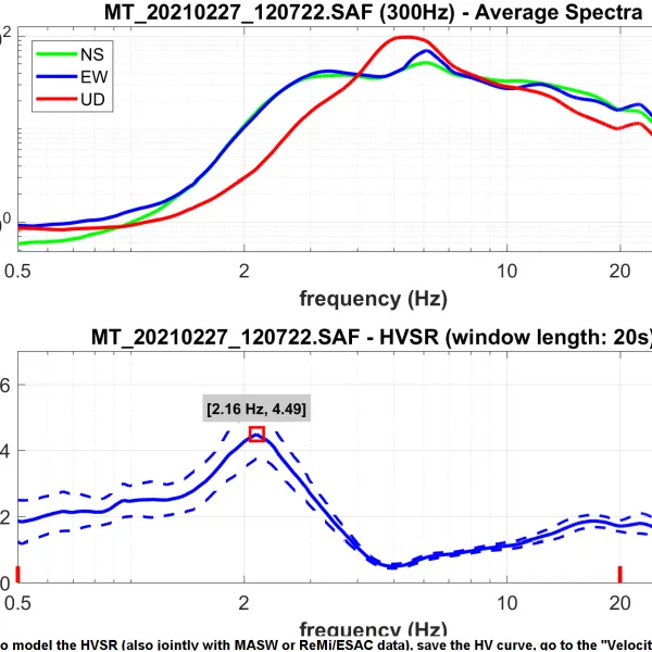
- Single-station HVSR measurements
- Joint MASW-HVSR and MASW-ESAC processing
- 3D GPR (dedicated page)
Applications
- Estimation of Vs along vertical profiles and cross-sections
- Estimation of the Vseq parameter (D.M. 17/01/2018, as amended)
- 2D seismic stratigraphic reconstruction
- Assessment of rock fracturing
- Thickness of the debris cover
- Bedrock profile for slope stability assessment
- Thickness of landslide bodies and location of the slip surface
- Classification of rock masses
- Stratigraphy of alluvial soils
- Fundamental resonant frequency of soils
- Elastic parameters of rock at small strains
How seismic waves propagate
A surface impact generates P waves (faster) and S waves (slower). As they pass through layers with increasing velocities, the wavefronts refract and generate head waves that return to the surface before the direct wave; some energy is reflected at the interfaces. Each geophone records arrivals and, trace by trace, the shot record forms, from which we derive the travel-time curves.
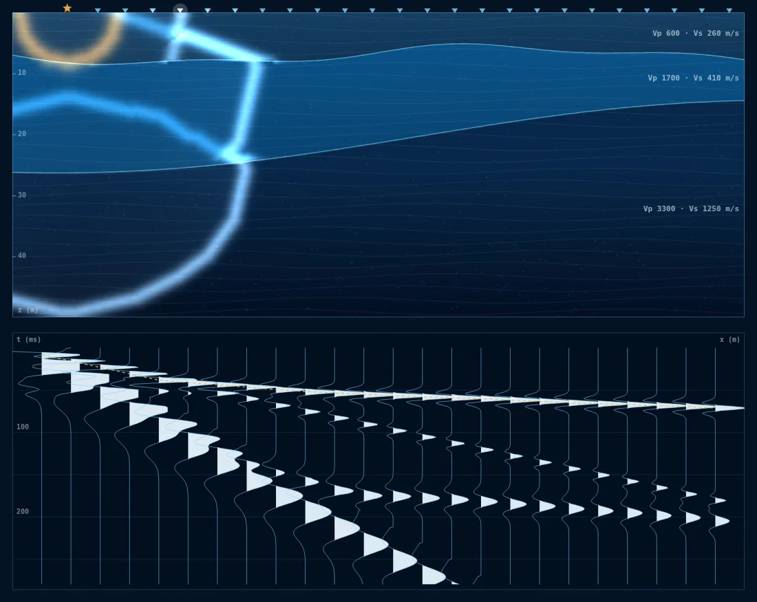
- P waves
- S waves
- Reflected waves
- Seismic traces, variable area
Images and results
Often combined with this survey
Planning a project?
Send us the location and objective of the survey: we will recommend a suitable combination of methods and provide a detailed quotation.